Drone Stills & Aerial Video
Aerial stills that show property scale, lot, setting, and neighborhood context. A simple add-on that sets any listing apart.
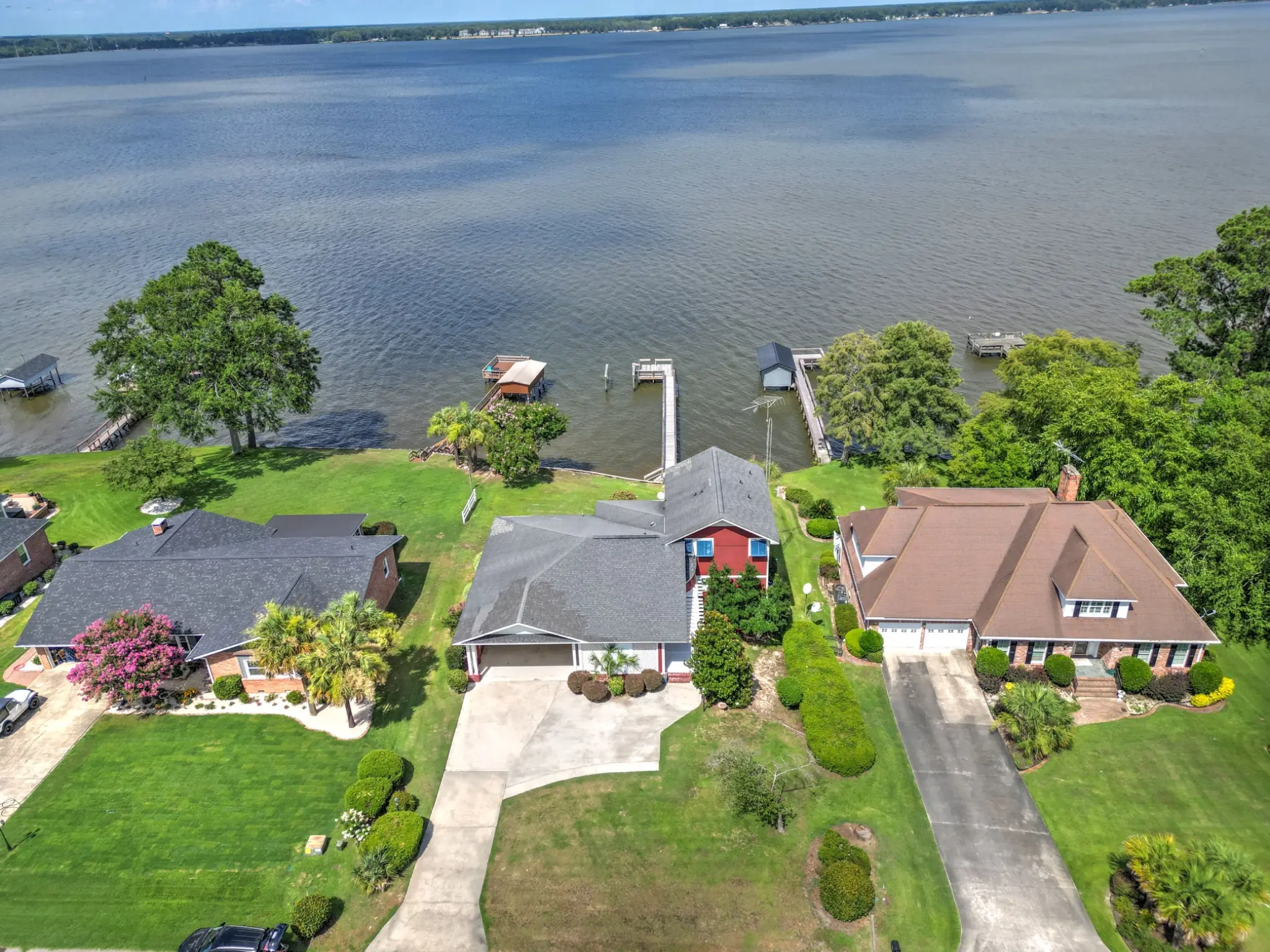
Aerial photography shows what ground-level images can't: property scale, lot boundaries, setting, and the neighborhood around it. It's one of the clearest ways to differentiate a listing and give buyers context before they visit.
Drone stills from $75
Drone stills are $75 as a standalone add-on, or bundle drone stills and a Zillow 360 tour for $100 when added to a photography booking. Aerial video is available as a scoped add-on. Every flight is planned around FAA airspace rules, weather, and site conditions, with airspace authorization requested where it's required.
When aerial makes sense
Aerial is especially valuable for properties with significant lot size, water access, acreage, or a setting that's hard to convey from the ground. It's also useful for showing proximity to amenities, parks, and community features that influence buyer decisions.
Related services
HDR Still Photography
Bright, accurate interior and exterior photography priced by square footage. The foundation of every listing package.
Learn moreImmersive Tours
Matterport 3D tours and Zillow 360 tours that give buyers a complete sense of the property before they ever schedule a showing.
Learn moreListing & Aerial Video
Property walkthroughs and aerial video for MLS, social, and advertising. One-minute video scoped by quote; autoreel photo-to-video for quick social posts.
Learn more